Coastal Dune Research report - 2008. Please contact us for the full report.
Stream Erosion Hazard report - 2022 Click here for the Report
Jim Dahm
Eco Nomos Ltd
Mobile: 0274 718 219
25 Adams Rd, RD5, Thames 3575
Member of the Focus Resource Management Group
Extracts from the Coastal Dune Research report - 2008
Summary
Ohau Sands is secure from coastal erosion and flooding and is likely to remain so over at least the next century, even with the worst likely sea
level rise over that period. The area can be vulnerable to wind erosion and careful management of access and use is addressed in the management plan.
Site Description and Coastal Setting
The beach to seaward is characterised by fine grained sands derived primarily from the greywacke Tararu Ranges, as typical of the Manawatu‐Wanganui coastline. Large volumes of sediment are delivered by various rivers draining to the coast, particularly the Wanganui, Rangitikei, and Manawatu.
The Manawatu‐Wanganui coast is backed by an extensive dune field, the largest in New Zealand – covering approximately 900 km2. The dune field consists largely of stabilised parabolic dunes which originally migrated inland from the coast. Conditions on this coast favour the development of transgressive (i.e.migrating) dunes due to the abundant sediment supply, the fine grained nature of the sediments, the dominant and strong onshore winds (being sufficiently strong to initiate sand transport about one third of the time) and the flat low gradient of the beaches (the latter factor exposing large surface areas to drying out and wind transport during lower tidal stages).
Ohau Sands is largely covered by stabilised parabolic dunes formed during the Waitarere Phase – i.e. inland migrating dunes formed largely as a consequence of human destabilisation of natural dune vegetation by early European land use activities. These and other inland migrating dunes along the Manawatu coast were only stabilised by extensive human intervention in the early‐mid 1900’s.
Coastal Hazards - Coastal erosion, coastal flooding and wind erosion
Coastal Erosion
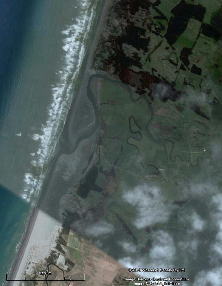
Assessment of coastal erosion hazard on this coast requires consideration of dynamic shoreline changes, dune face collapse following severe erosion, any long term trends for shoreline advance or retreat and the potential impact of projected climate change. In addition, the potential for erosion associated with stream entrance changes has to be considered for areas of the property closest to the Waiwiri and Ohau Stream entrances.
Field inspection indicates a well vegetated frontal dune that appears to be actively accreting, with no evidence of historic erosion scarps.
In relation to long term trends, the shoreline along this coast has prograded approximately 4 km seaward since sea level stabilised at or about existing elevations some 6500‐7500 years ago. This suggests a time‐averaged rate of seaward advance in the order of 0.6 metres per year.
Accordingly, the worst likely coastal erosion over the next 100 years is unlikely to impact the property. Equally significantly, it is unlikely to reduce the maximum height of the existing wide protective dune seaward of the property.
Coastal associated with Stream entrances
Aerial photography indicates that the larger Ohau River entrance has in recent decades migrated considerable distances alongshore – eroding the dunes over a distance of at least 3‐3.5 km alongshore and up to 600‐650 m inland from the current shoreline. However, this entrance migration has been southwards alongshore in the direction of net littoral drift. Morphologic evidence suggest this has been the prevailing direction of alongshore entrance migration for this river and that the entrance has not moved significantly northwards alongshore in recent decades. The river is eroding dunes on the true right bank in some areas in its lower reaches but the channel in these areas lies at least 800‐1000m south of the proposed subdivision. In my opinion, given the prevailing southwards littoral drift and current stream conditions, it is extremely unlikely that the Ohau River will erode sufficiently far northwards to affect the proposed subdivision in the foreseeable future.
Coastal flooding - waves and storm surge
Ohau Sands is fronted by a wide and relatively high frontal foredune, with the property boundary and highest areas of the dune crest approximately 65 m inland and up to 11 m high. In my opinion, this frontal dune provides more than adequate protection from coastal flooding associated with storm surge and wave effects. Moreover, as noted above, erosion associated with projected sea level rise is unlikely to extend landward to the present dune crest even allowing for sea level rise of up to 1.5 m. Accordingly, the wide foredune is likely to continue to provide adequate protection from storm surge and wave coastal flooding, even with upper limit estimates of sea level rise over the next 100 years.
Coastal flooding associated with tsunami
The 500 year return period tsunami for the Horowhenua District coastline in the area of this subdivision is estimated to lie in the range of 0 to 2 m, including tsunami from all potential sources, both local and distant.
Accordingly, given the wide high frontal dune seaward of the development and typical ground elevations within the areas for buildings of around 3 ‐ 4 m above mean sea level, and even higher at up to 20m in places, the risk from tsunami flooding is assessed as negligible for events with return periods up to at least 500 years.
Wind erosion
This coast has a natural propensity for severe wind erosion andhas experienced various phases of transgressive dune formation. Ohau Sands is largely covered by (now stabilised) low transgressive dunes formed during the most recent (Waitarere) phase of serious wind erosion and transgressive dune formation.
In contrast, Ohau Sands development and the frontal dune to seaward presently show little evidence of wind erosion. The property itself has been managed and a useful forest cover established and maintained by the present owners.
Examination of aerial photography on Google Earth indicates only relatively minor areas of blow‐outs and wind erosion within the property. The frontal foredune to seaward also has very good vegetation cover and has no evidence of any serious wind erosion.
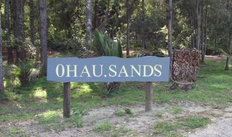
About Us - Ohau
Ohau Sands is a unique gated community offering a santuary lifestyle in the Horowhenua area.
Contact Us
New Zealand Sotheby’s International Realty
Marcus D'Cunha:
Mobile +64 22 322 4193
Email: Marcus.DCunha@wellington.nzsir.com
Suzette McCartney
Mobile +64 22 198 9139
Email: suzette.mcartney@nzsir.com
Instagram Link